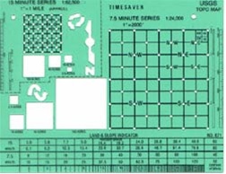
A Land & Slope Indicator Template is a tool used to measure the slope of the land on a topographic map. It's typically a transparent plastic sheet with printed lines and scales.
How to Use a Land & Slope Indicator Template:
- Align the Template: Place the template on the topographic map, aligning the straight edge with a contour line.
- Read the Slope Percentage: Use the scales on the template to determine the percentage of slope between the two contour lines.
- Identify Landforms: The template can also help identify landforms like hills, valleys, and ridges by analyzing the contour lines.
Key Features of a Land & Slope Indicator Template:
- Clear Scales: Easy-to-read scales for measuring slope percentages.
- Durable Material: Made from durable plastic for long-lasting use.
- Compact Size: Portable and easy to carry in a backpack or field kit.
- Versatile: Can be used with various topographic map scales.