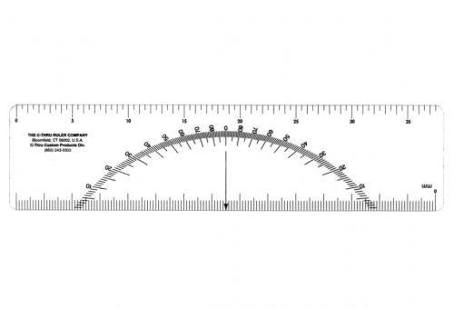
C-Thru Metric Protractor Scale - 1:3000/1:6000 -Discontinued 2019
The C-Thru Metric Protractor Scale 1:3000/1:6000, like the Land Measure Compass, was a specialized tool that has been discontinued. It was specifically designed for use with topographic maps at 1:3000 and 1:6000 scales.
While the exact model is no longer available, there are still alternative tools and techniques that can be used for measuring distances and angles on maps.
Alternative Approaches:
-
Digital Mapping Tools:
- GIS Software: Geographic Information Systems (GIS) software like ArcGIS or QGIS can be used to accurately measure distances and angles on digital maps.
- Online Mapping Tools: Websites like Google Maps and OpenStreetMap offer tools for measuring distances and areas.
-
Traditional Map Reading Techniques:
- Map Scale: Use the map's scale to measure distances using a ruler or dividers.
- Protractor: A standard protractor can be used to measure angles on the map.
- Compass: A compass can be used to measure bearings and calculate distances.
This product is no longer available.
Your Dynamic Snippet will be displayed here...
This message is displayed because youy did not provide both a filter and a template to use.
