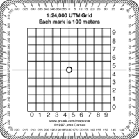
Map Tools 1:24,000 Scale Pocket Size UTM Grid
The MapTools 1:24,000 Scale Pocket Size UTM Grid is a handy tool for accurately reading and plotting Universal Transverse Mercator (UTM) coordinates on 1:24,000 scale topographic maps.
Key Features:
- Clear Grid Lines: The grid lines are clearly marked, making it easy to read and plot coordinates.
- Compact Size: The tool is small and lightweight, fitting easily in your pocket or backpack.
- Durable Construction: Made from durable plastic, ensuring long-lasting use.
- Easy to Use: Simply align the tool with the map grid to read the easting and northing values.
Your Dynamic Snippet will be displayed here...
This message is displayed because youy did not provide both a filter and a template to use.
